
Features Gammertingen
The interactive guide for the "Städtle" - as Gammertingen is affectionately called by the locals.
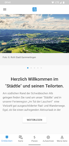
Our Laucherttal town is located in the northern tip of the Sigmaringen district and not at all behind the moon, but somewhat hidden on the southern edge of the Swabian Jura.
With its attractive landscape with the winding Lauchert/Fehlatal, the beautiful plateaus of the Swabian Alb, the extensive forests and the healthy bracing climate, it is an ideal starting point for various leisure activities such as cycling or hiking.Whether alone, in a group or with the family, you will find a wide range of activities around Gammertingen.This guide offers GPS tracks of our city history tours, hikes, bike tours, cross-country ski trails and more - including detailed descriptions.Our tours all have detailed information such as:- Outdoor map- Key facts (length, altitude difference, duration, difficulty)- Detailed description including pictures- Tour course in the map- Elevation profile- Sights (churches, monuments, buildings)- Refreshments and accommodation options- Excursion destinations in the vicinityHave fun in Gammertingen
Weather Features
Get accurate weather forecasts and real-time updates.
Fitness Tracking
Track your workouts and monitor your health metrics.
Travel Features
Plan and manage your travels with ease.
See the Gammertingen in Action


Get the App Today
Available for Android 8.0 and above